New, Quality Books - 50-90% off, over 2500 titles
Your basket is empty.
Categories Great Britain, Maps & the Environment ISLAND LONDON MAPPED: 34 POSTERS Ask question
Submit question about product
If you want to send us a question about this product, simply complete all the fields marked * and click "Send".
|
Bibliophile price
£6.00
Published price
$29.95
|
|
|
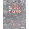
Like a huge jigsaw with pieces the size of the book (27.5 x 20cm) 34 pull out posters can be removed and perhaps even linked if you're clever! Or framed and admired for their astonishing detail and humour, witty observations about cultural life (very expensive nightclubs, football and Ford). In his fantastically detailed maps of the city, Stephen Walter translates these elements into a tangle of insightful yet humorous words and symbols as he explores the boroughs and the City, places of historic interest and birthplaces of important figures. His groundbreaking, oversized map The Island was one of only two works by contemporary artists to feature in the seminal Magnificent Maps exhibition held at the British Library in 2010, the other by Grayson Perry and was exhibited together with some of the most important maps in history, such as Pierre Desceliers's 1550 world map. The work, which reimagines London as an insular body of land surrounded by water, has now been reconfigured and turned into Walter's own version of a London street atlas, from Barking and Dagenham, Barnet, Haringey, Islington to Kingston. A key at the end explains symbols like pawn broker, markets, or where public hangings took place. The large-scale, detailed reproductions allow for close examination of his witty and inventive depictions. Walter's cartographic renderings have a cult following. 33 posters on heavy art card and key to symbols. Rare Prestel first edition 2015. 144 pages.
In stock |
|

