New, Quality Books - 50-90% off, over 2500 titles
![]()
Your basket is empty.
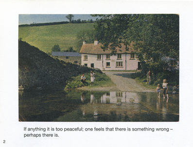
Categories Last Chance to buy! DREAMSTREETS: A Journey Through Britain's Village Utopias
Categories Great Britain, Maps & the Environment ISLAND LONDON MAPPED: 34 POSTERS
Categories Nature/Countryside CROSSLEY ID GUIDE: Britain and Ireland
Categories Nature/Countryside ACCIDENTAL COUNTRYSIDE: Hidden Havens
Categories Humour POSTCARD FROM THE PAST
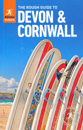
Categories Last Chance to buy! ROUGH GUIDE TO DEVON & CORNWALL
Categories Last Chance to buy! FRINGED WITH MUD AND PEARLS: An English Island Odyssey
Categories Great Britain, Maps & the Environment LOST ENGLAND 1870-1930
Categories Great Britain, Maps & the Environment O JOY FOR ME!
Categories Last Chance to buy! SWINGING THE LAMP
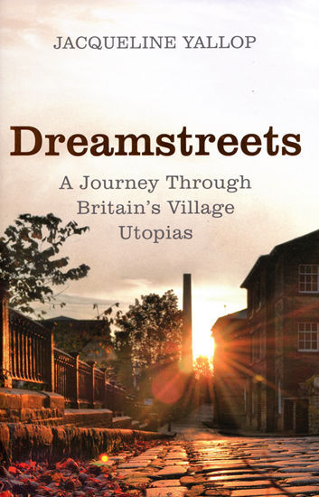
DREAMSTREETS: A Journey Through Britain's Village Utopias
Book number: 93281
Product format: Hardback
In stock
£6.00
Customers who bought this product also bought
 |
 |
 |
 |
 |
 |
Browse these categories as well: Last Chance to buy!, Travel & Places, Great Britain, Maps & the Environment
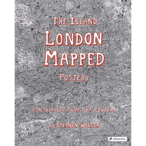
ISLAND LONDON MAPPED: 34 POSTERS
Book number: 88946
Product format: Paperback
In stock
£6.00
Customers who bought this product also bought
 |
 |
 |
 |
 |
 |
Browse these categories as well: Great Britain, Maps & the Environment, Travel & Places, First Editions
CROSSLEY ID GUIDE: Britain and Ireland
Book number: 93483
Product format: Paperback
In stock
£8.00


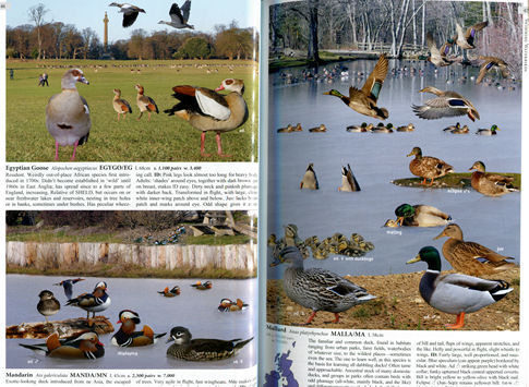


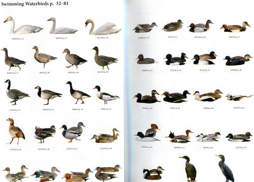
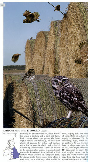

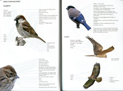
Billed as "The most user-friendly guide to the Birds of Britain and Ireland", this soft-backed chunky volume would just about fit in a capacious pocket, certainly a rucksack, and covers over 300 different common species. The Unique Selling Point of the volume is the illustrations. Each bird is presented in close-up photography from a number of different angles, sometimes as many as ten, against a typical background, but instead of the usual long-range shot without much detail, the close-up photos are presented in montage, so a far greater degree of clarity and accuracy is achieved. The first 12 pages consist of thumbnail quick identifiers of all the birds, categorised as swimming, flying or walking waterbirds, followed by upland gamebirds, raptors, miscellaneous larger landbirds, and songbirds. The main text for each bird includes the bird's length next to the name of the species, given with the English and scientific names. On each plate, plumage, age and sex are labelled, and the text describes population, behaviour, flight, identification points, and general quirks and peculiarities. The song is described, though this is a challenge: the whimbrel has "a 7-note tittering call pupupu" while a waxwing has "a distinctive, trilled sree, sibilant like a pea-whistle". Described as a "birders' favourite", the waxwing can eat up to a thousand berries a day and is often found in car parks, immune to human activity. Apart from the birds themselves, the photos of habitat are also gorgeous. 302pp, softback, colour photos.
Click YouTube icon to see this book come to life on video.
Click YouTube icon to see this book come to life on video.
Additional product information
| Author | RICHARD CROSSLEY & D. COUZENS |
| Product Format | Paperback |
| ISBN | 9780691151946 |
| Published Price | £20 |
Customers who bought this product also bought
 |
 |
 |
 |
 |
 |
Browse these categories as well: Nature/Countryside, Great Britain, Maps & the Environment, Science & Maths, EXPLORE NATURE
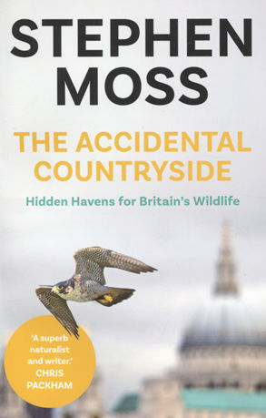
ACCIDENTAL COUNTRYSIDE: Hidden Havens
Book number: 93555
Product format: Paperback
In stock
£3.00
Customers who bought this product also bought
 |
 |
 |
 |
 |
 |
Browse these categories as well: Nature/Countryside, Great Britain, Maps & the Environment
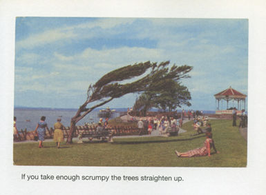
POSTCARD FROM THE PAST
Book number: 93588
Product format: Paperback
In stock
£3.75


Customers who bought this product also bought
 |
 |
 |
 |
 |
 |
Browse these categories as well: Humour, Great Britain, Maps & the Environment, 5-10 GIFTS
ROUGH GUIDE TO DEVON & CORNWALL
Book number: 93593
Product format: Paperback
In stock
£5.50
Customers who bought this product also bought
 |
 |
 |
 |
|
 |
Browse these categories as well: Last Chance to buy!, Travel & Places, Great Britain, Maps & the Environment
FRINGED WITH MUD AND PEARLS: An English Island Odyssey
Book number: 93635
Product format: Hardback
In stock
£7.50

Customers who bought this product also bought
 |
 |
 |
 |
 |
 |
Browse these categories as well: Last Chance to buy!, Travel & Places, Nature/Countryside, Great Britain, Maps & the Environment
LOST ENGLAND 1870-1930
Book number: 93714
Product format: Hardback
In stock
£28.00
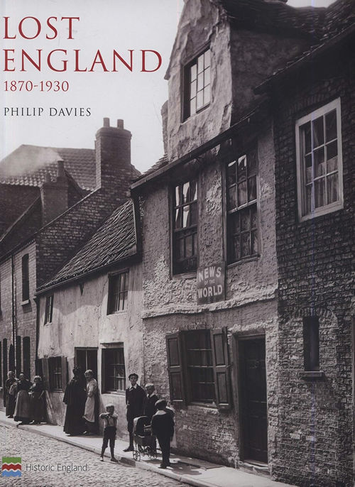
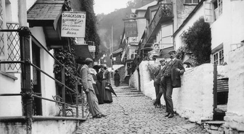
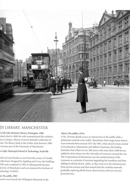

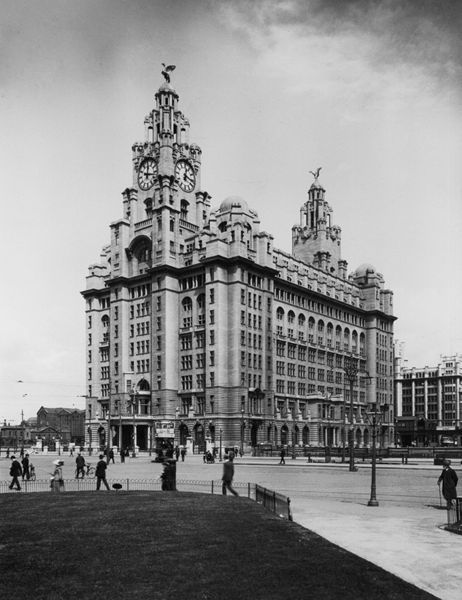
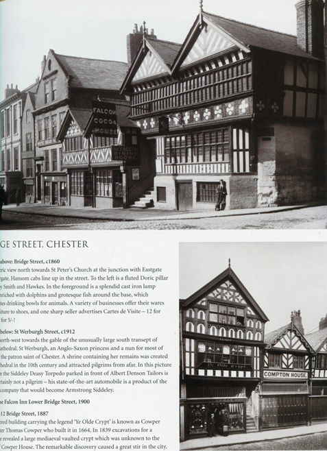
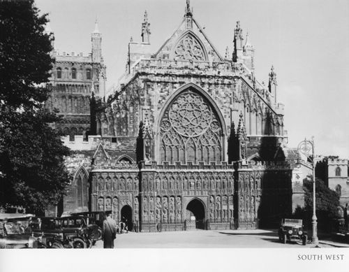
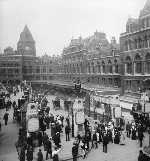
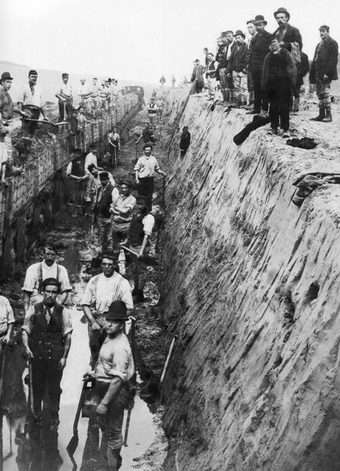
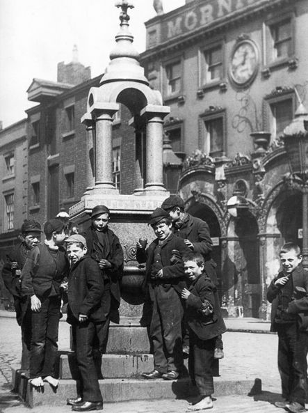
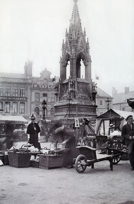
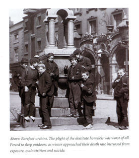
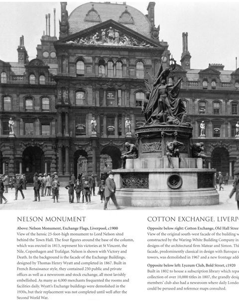
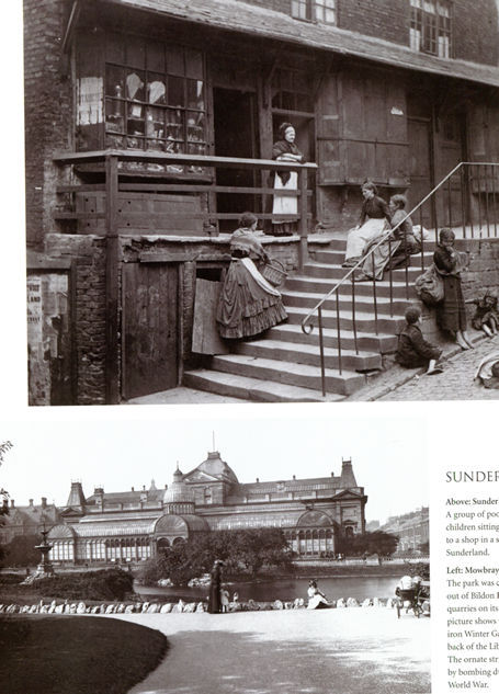
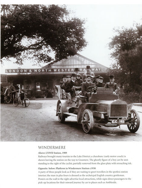
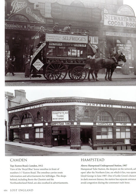
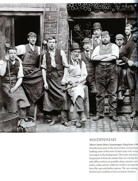
From the Historic England popular series by the historian who has researched incredible photographic archives and who here selects 1,200 of the best images depicting the yards and alleys of Georgian and Victorian London and Britain, the maze of medieval streets, transformation of shopping areas and lost buildings. Once sleepy villages and market towns during this period were engulfed by a tide of development - Manchester, Birmingham, Liverpool and Leeds exploded across the face of England and railways wrought massive changes as their iron tentacles spread across the landscape. By 1900 nearly 80% of England's population lived in urban areas, compared with just one third 100 years earlier. Ranging from 1870, the midpoint of Queen Victoria's reign, England was entering the Great Depression. Education became a statutory right, putting children at school desks rather than setting them to work. Women were being given control of any wages they earned and they began their long fight for equality. European rivalry accelerated and Britain's industrial and commercial pre-eminence was challenged by foreign competition. It was the age of the internal combustion engine, the telephone, radio, and aviation lay just around the corner and photographs were now able to record the moment. Most were taken to provide a permanent record of areas which were vanishing, and the quality of the images are of the highest quality of the time showing early railways, coaching inns, horse-drawn travel, the offices of the White Star Line Liverpool 1898, mock Tudor homes in Port Sunlight model village, Knebworth, fishermen's towns like Newlyn Cornwall 1907 with women and children and a man at work, New Street Station, grand civic buildings and town halls, Fry's chocolate in glamorous shop windows, tea rooms and formal gardens, back-to-backs, puppet shows and village life, markets and railway workers, Windsor Castle and Stonehenge with silk top-hatted gentlemen visiting, a windmill being demolished, watermen selling water with a bonneted child alongside her parents and his cart. The images are grouped by Northwest, Northeast, East Midlands, West Midlands, East England, South and Southeast, London, South and Southwest. A spectacular heavyweight large volume 10" x 11¾", 560 glossy pages.
Click YouTube icon to see this book come to life on video.
Click YouTube icon to see this book come to life on video.
Additional product information
| Author | PHILIP DAVIES |
| Product Format | Hardback |
| ISBN | 9781909242791 |
| Published Price | £50 |
Customers who bought this product also bought
 |
 |
 |
 |
 |
 |
Browse these categories as well: Great Britain, Maps & the Environment, Travel & Places, History

Customers who bought this product also bought
 |
 |
|
 |
 |
 |
Browse these categories as well: Great Britain, Maps & the Environment, Travel & Places
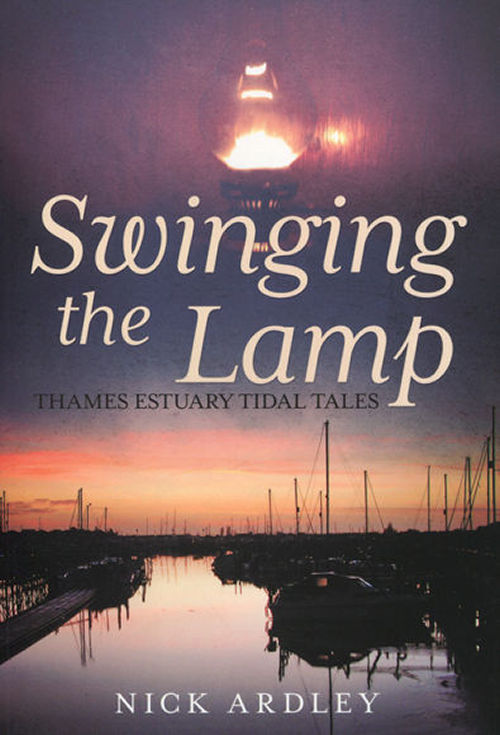
SWINGING THE LAMP
Book number: 93775
Product format: Paperback
In stock
£6.50
Customers who bought this product also bought
 |
 |
 |
 |
 |
 |
Browse these categories as well: Last Chance to buy!, Great Britain, Maps & the Environment, Transport


